The Philadelphia Map Society visited the Hagley Library on April 9 and viewed a display of maps from the Manuscripts and Archives Department. The maps ranged from early nineteenth-century property documents to twentieth century transportation routes, and urban planning studies.
Among the items diplayed were:
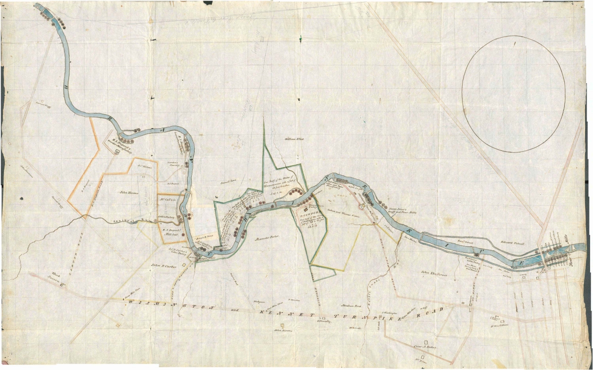
A map of mill seats on the Brandywine River, 1816:
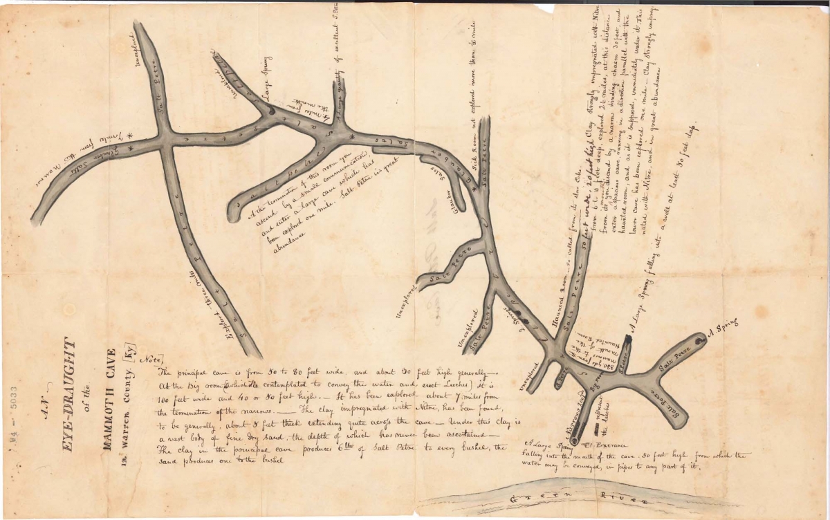
A drawing of Mammoth Cave area in the 1810s:
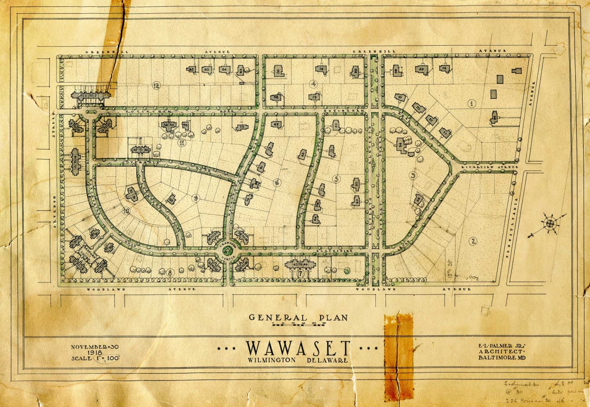
A plan for Wawaset Park, a residential development in Wilmington, DE, 1918:
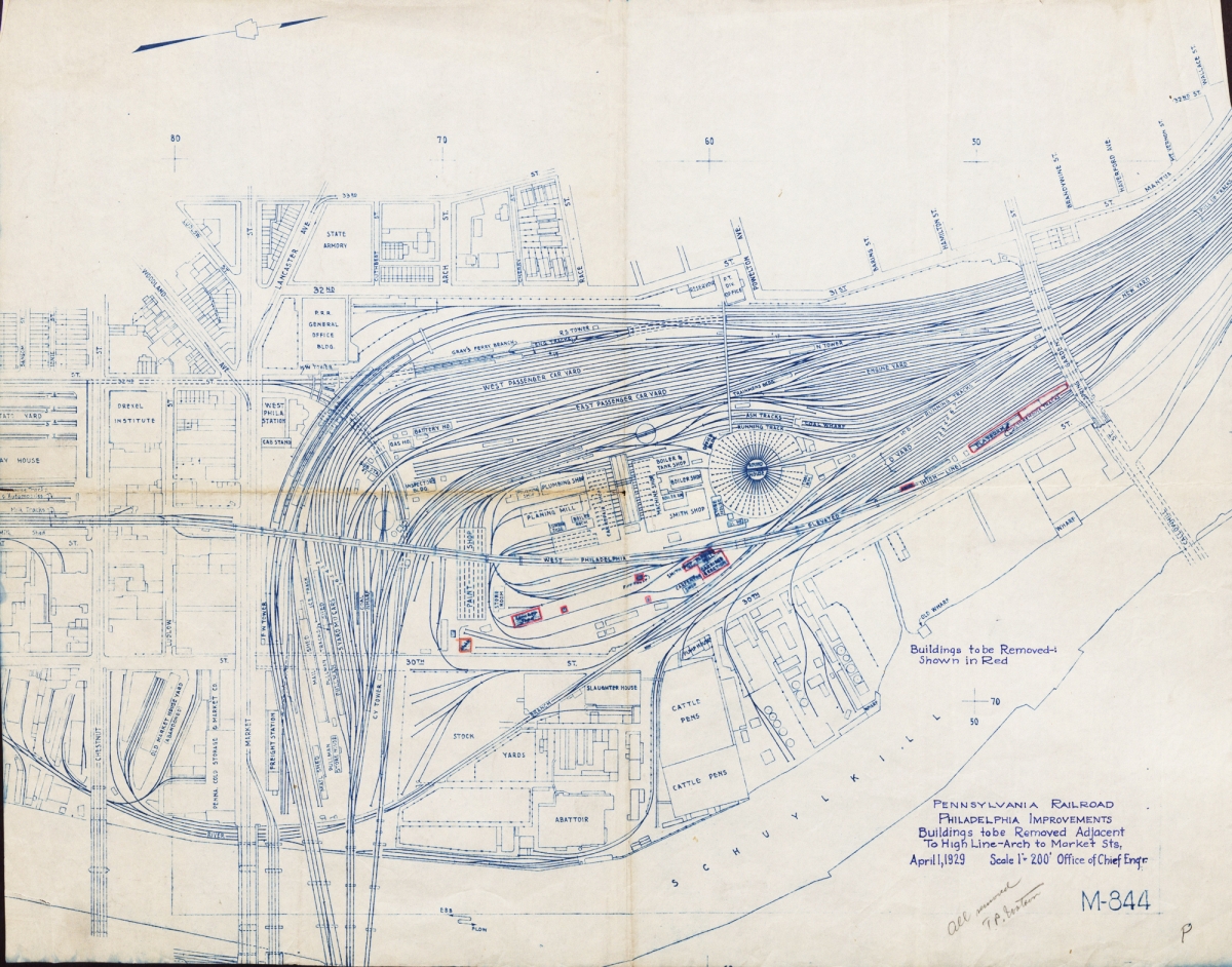
A Pennsylvania Railroad map showing buildings for demolition between Arch and Market Streets in Philadelphia, 1929:
Hagley’s Library has a wide range of maps that are included in a number of collections. For more information, contact us at AskHagley@hagley.org.
Lynn Catanese is the Chief Curator of Library Collections, Manuscripts and Archives Department, at Hagley.